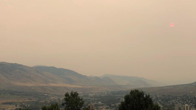
Smoky skies bulletin still in effect for Kamloops and area
Sep 12, 2022 | 6:01 AM
Aaron Schulze
KAMLOOPS — Wildfire smoke continues to impact several regions of B.C., including Kamloops and area.
Environment Canada issued a smoky skies bulletin for the 100 Mile, Cariboo, Nicola, Shuswap, and North and South Thompson Sunday (Sept. 11) but the notice continues into Monday (Sept. 12) morning.
According to Environment Canada, the bulletin is due to smoke from local wildfire activity and from several fires in the United States. The weather agency says local smoke conditions may worsen if fire activity increases.
Two of the most notable fires are in the Coastal Fire Centre. According to the BC Wildfire Service Dashboard, the Flood Falls Trail wildfire west of Hope is measured at 459 hectares as of Monday morning, while the Heather Lake wildfire east of E.C. Manning Provincial Park is at 8,663 hectares in size.
Due to the wildfire near Hope, DriveBC says all eastbound traffic on the Trans Canada Highway in the area will be detoured via Highway 9 to Highway 7, or Highway 11 to Highway 7. Drivers are asked to watch for traffic control and to not stop for pictures and videos.
Further north in the Prince George Fire Centre, the Battleship Mountain wildfire west of Hudson’s Hope and North of Mackenzie is at a staggering 24,284 hectares in size, while the Bearhole Lake wildfire south of Dawson Creek is measured at 6,313 hectares.
While wildfire smoke is a natural part of the environment, Environment Canada says it is a constantly changing mixture of particles and gases which includes many chemicals that can harm people’s health. People with pre-existing health conditions, respiratory infections such as COVID-19, older adults, pregnant women and infants, children, and sensitive individuals are more likely to experience health effects from smoke exposure.
Residents are encouraged to take extra steps to reduce exposure to wildfire smoke.